
Reviewed by Josh N · Updated August 27, 2026 · How we verify
Reported Phenomena
- Phantom soldiers
- Ghost dog patrol
- Cemetery apparition
- Shadow figures
- Electronic interference
Reported by visitors & local legend. Stories, not verified claims.
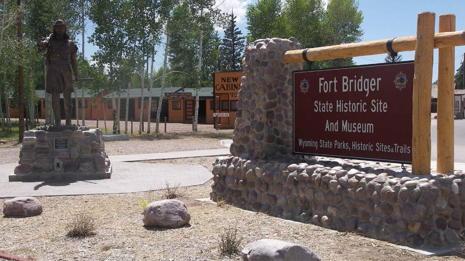
Fort Bridger State Historic Site sits on Blacks Fork of the Green River in Uinta County, Wyoming, on ground that was Mexican territory when a mountain man first drove stockade logs into it. What survives today is layered: a replica of Jim Bridger’s trading post, a Mormon protective wall, an old Pony Express barn, and the quarters and storehouses of a US Army depot that operated until statehood. The ghost stories attached to it are layered too, and they belong to the military chapter more than the fur trade one.
Quick Facts: Fort Bridger at a Glance
- Founded: as a fur trading outpost in 1842, by mountain man Jim Bridger and his partner Louis Vasquez
- Location: Blacks Fork of the Green River, Uinta County, Wyoming, then part of Mexico
- Role: resupply point for wagon trains on the Oregon, California and Mormon Trails
- Army post: established 1858 during the Utah War, closed 1890
- Site today: 37 acres, 27 original buildings and a reconstructed trading post
- Preserved since: sold to the Historical Landmark Commission of Wyoming on 27 June 1928
Four Log Cabins on Blacks Fork
In December 1843 Bridger wrote to Pierre Chouteau Jr. that he had “established a small fort, with a blacksmith shop and a supply of iron in the road of emigrants on Black Fork of Green River, which promises fairly.” It was not much of a fort. The writer Stanley Vestal described an eight-foot stockade with a corral adjoining on the north and four log cabins with flat dirt roofs inside: one for the forge and carpenter’s bench, one for the store, one for Bridger’s family, and one for Vasquez.
Visitors kept leaving descriptions, and they broadly agree. Orson Pratt, arriving with the first party of Mormon pioneers on 7 July 1847, called it “two adjoining log houses, dirt roofs, and a small picket yard of logs set in the ground, and about eight feet high,” with nine native lodges nearby. Mrs. Benjamin G. Ferris, passing through on 19 October 1852, saw “a long, low, strongly-constructed log building, surrounded by a high wall of logs, stuck endwise in the ground.”
Its value was position, not architecture. Richard Francis Burton, who came in August 1860, wrote that Bridger had placed the post “upon a kind of neutral ground” between the Snakes and Crows to the north, the Oglalas and other Sioux east, the Arapahoes and Cheyennes south, and various Ute bands to the southwest. Bridger, often called the Daniel Boone of the Rockies, filed a claim with the General Land Office on 9 March 1854 for the 3,800 acres around his post.
The Letter That Sent the Donner Party West
Fort Bridger has one grim footnote in emigrant history. Lansford Hastings published The Emigrant’s Guide to Oregon and California in 1845, advising California-bound travellers to leave the Oregon Trail here, cross the Wasatch Range and the Great Salt Lake Desert, loop the Ruby Mountains and rejoin the California Trail west of what is now Elko, Nevada. The Donner-Reed Party took that route. On 12 July they received a letter from a rider Hastings had sent out, claiming he had “worked out a new and better road to California” and would be waiting at Fort Bridger to guide them. The rest of that story happened elsewhere, but the decision point was here.
Fort Supply, a Disputed Deed and the Fire of 1857
Relations between Bridger and the Mormon settlers soured quickly. By 1853 a Mormon militia was sent to arrest him for selling alcohol and firearms to Native Americans in violation of federal law. He escaped and went east for a time. That November, Orson Hyde arrived with 39 settlers and founded Fort Supply on Willow Creek, about twelve miles southwest.
In 1855 the Mormons took over Fort Bridger, reportedly paying $8,000 in gold coins. The transaction has never been clean: they claimed to have bought it from Vasquez, Bridger denied it, and the deed dated 3 August 1855 carried both men’s names signed by a third party, H. F. Morrell, supposedly under power of attorney. Bridger was away that year guiding Sir St George Gore. The historian Andrew Jenson recorded that from 1853 to 1857 Fort Bridger was “quite an important ‘Mormon’ outpost,” and that both it and Fort Supply were deserted in September 1857 as Colonel Johnston’s army approached.
The buildings did not survive the handover. As 2,500 troops advanced in November 1857 during the Utah War, the Mormons set fire to Fort Bridger. Johnston kept his supplies and a garrison inside the stone walls that remained while the army wintered at nearby Camp Scott. Bridger had leased his surveyed land to the United States on 18 November 1857, though payment was withheld until he could establish title.
Judge Carter’s Store and the Treaty of 1868
Major William Hoffman took command of the army depot on 7 June 1858. Elements of the Sixth and Tenth Infantry and the First Cavalry put up storehouses and troop quarters, and on 14 July 1859 orders set aside a military reservation of 500 square miles. Command changed hands repeatedly through the Civil War years and after.
The constant was a civilian. William A. Carter was appointed post sutler in 1858 and stayed at the centre of the fort’s life until his death in November 1881, running his store and the post office under one roof. He was a probate judge who had served in the army during the Seminole Wars. His widow, Mary Elizabeth Hamilton Carter, took over as sutler and then post trader until 1890.
On 3 July 1868, Chief Washakie signed the Fort Bridger Treaty here, ceding Shoshone and Bannock lands in southwestern Wyoming and creating the Wind River Indian Reservation. Troops from the fort later guarded construction of the Union Pacific’s Overland Route and the Overland Stage and Mail line. In the summer of 1870 the Yale professor Othniel Charles Marsh used the fort as a base camp for a geological expedition, and Ferdinand Vandeveer Hayden’s survey worked out of it from 12 September to 1 October that year.
Closed in 1890, Rededicated in 1933
The railroads made frontier posts like this one redundant. Fort Bridger was abandoned in 1878, re-established two years later, and closed for good by the Army in 1890, the year Wyoming became a state. On 27 June 1928 the site and its remaining buildings were sold to the Historical Landmark Commission of Wyoming, and dedication ceremonies on 25 June 1933 established it as a Wyoming Historical Landmark and Museum. The Annual Fort Bridger Muzzle Loading Rendezvous has been held there every Labor Day weekend since.
The Soldiers and the Dog: What People Report Here
None of the following is documented history. These are accounts from visitors and site employees, repeated over years, and they should be read as folklore attached to a place with a long military occupation rather than as verified events.
- Soldiers who have not stood down. Figures in military dress are reported around the grounds and buildings, described as going about duties rather than reacting to the living.
- A patrolling dog. The most distinctive story here concerns a military dog said to still walk the site, remembered locally as heroic.
- The watchman in the cemetery. The Fort Bridger Cemetery draws the most sightings, in particular a military man described as keeping watch over the graves.
- Shadow figures. Dark shapes crossing open ground and moving between structures, usually seen at the edge of vision.
- Interference with equipment. Staff and visitors have described electronics behaving oddly inside the old buildings, which some interpret as playful spirits and others as the ordinary unreliability of gear in a nineteenth century wooden building.
Worth noting: the fort’s violent history is real enough, but there is no record here of a single mass casualty event of the kind that usually anchors a haunting. The stories are diffuse, which is either a mark against them or simply what a century of continuous occupation leaves behind.
Visiting Fort Bridger State Historic Site
The site covers 37 acres and preserves 27 authentic buildings alongside a replica of Bridger’s original trading post. Among the older survivals are the Pony Express barn and the Mormon protective wall, both of which predate most of what stands around them. Tours, living history demonstrations and ongoing archaeological excavation are all part of the visit, and the excavations mean the interpretive story here is still being revised.
If you want the fort at its busiest and most theatrical, Labor Day weekend brings the Muzzle Loading Rendezvous. If you want it quiet, and if the cemetery is your reason for coming, go on an ordinary weekday and walk it slowly. Check current opening hours with the Wyoming Department of State Parks and Historic Sites before you drive out, since seasonal schedules apply.
Sources
- Fort Bridger, Wyoming State Historic Site
- Fort Bridger Photos
- About – Fort Bridger State Historic Site (Wyoming Wyoparks (official))
- Wyoming State Parks, Historic Sites, & Trails (Wyo (official))
- William Alexander and Mary E. Carter papers – Archives West
- Wikipedia: Fort Bridger
Address: 37000 Business Loop I-80
Frequently Asked Questions
Where is Fort Bridger State Historic Site located?
Fort Bridger State Historic Site is located at 37000 Business Loop I-80.
Can you visit Fort Bridger State Historic Site?
Fort Bridger State Historic Site is open to the public. Always follow posted rules and respect private property.
Reader sightings
Nobody has reported anything here yet. If you have been, you would be the first.
Report your own visit to Sentries and a Sentry Dog: Fort Bridger State Historic Site
How haunted is this place?
Be the first to rate
Ghost Tours Nearby

Affiliate links: BeyondHaunted may earn a commission, at no extra cost to you.
Leave a Reply